One of my favorite regions in Washington state is the Gifford Pinchot National Forest. Now that the snow has melted in late spring, I’ve been making several trips to the area throughout the summer and fall to enjoy the outdoors.
Growing up, my family spent many days camping in this beautiful area. In addition to our summer visits, my dad and his friends set up a six-week hunting camp in various locations around the forest each year. I visited the hunting camp on weekends (and a few missed school days!).
Those times in the woods are when I learned so much about the outdoors. The memories of those experiences are what make this region so special to me.
These days, my opportunities to explore the Gifford Pinchot have been limited to day trips during my 24-hour shifts at the fire department. My work schedule prevents me from getting an early start, so I usually arrive at the areas I visit late in the morning.
After fueling up in Randle, Washington, I set off to the forest lands south of Highway 12 along Forest Road 25. Along the way, I pass places that hold fond memories of past trips: Huffaker Mountain, Woods Creek, and Kraus Ridge, to name a few.
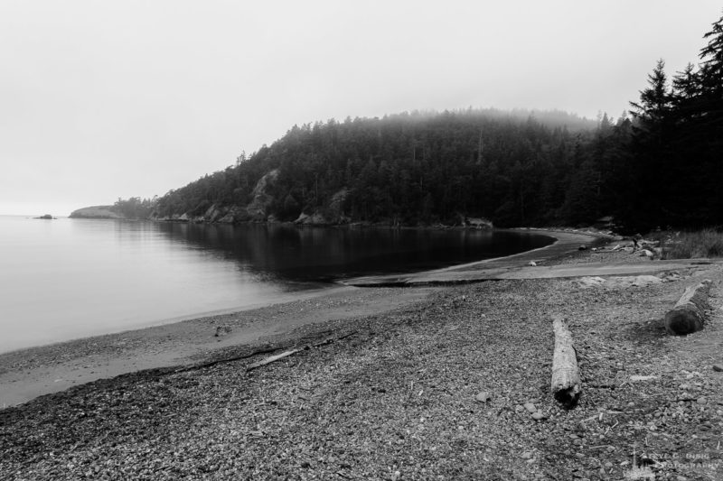
Without a specific destination, I drove across the Cispus River and up Ryan Lake Road (Forest Road 26) on my most recent visit.
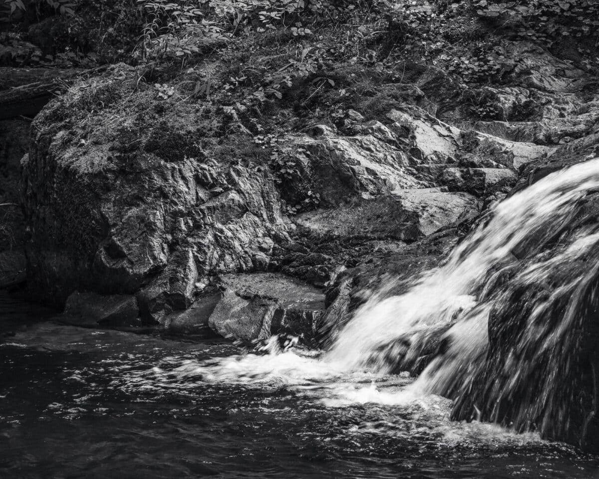
Quartz Creek Waterfalls
After leaving Forest Road 25 and the Cispus River Valley, Ryan Lake Road begins its climb. The paved forest road has some gravel and sunken sections along the way. Once the road rounds the end of a ridge, it follows the Quartz Creek drainage, passing through clear-cut areas in various stages of regrowth.
As Ryan Lake Road crossed over Quartz Creek, I stopped to look for potential photo compositions. That’s when I noticed a small waterfall upstream.
I bushwhacked a short distance and soon found myself at the base of the waterfall. I was pleasantly surprised by the volume of water still flowing this early in September.
Given that it was mid-afternoon, the lighting was harsher than I would have preferred for photography. However, I worked the scene and found a composition that included the rock face and the water flowing into the pool below.
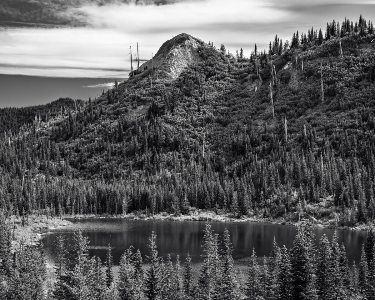
Green River Valley
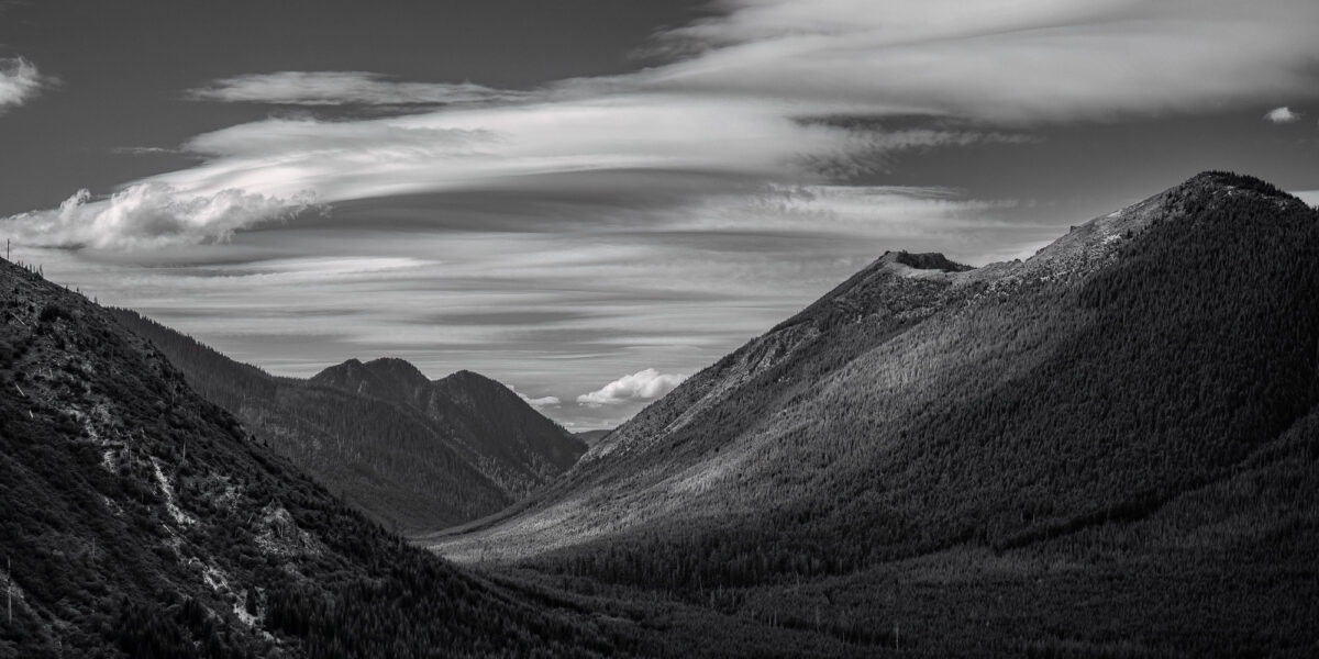
I quickly drove up Forest Road 2612 through the Green River Valley until I reached the road’s end. Since it was Labor Day weekend, all the trailhead parking areas were full. This part of the Gifford Pinchot National Forest has multiple trails and old mines to explore.
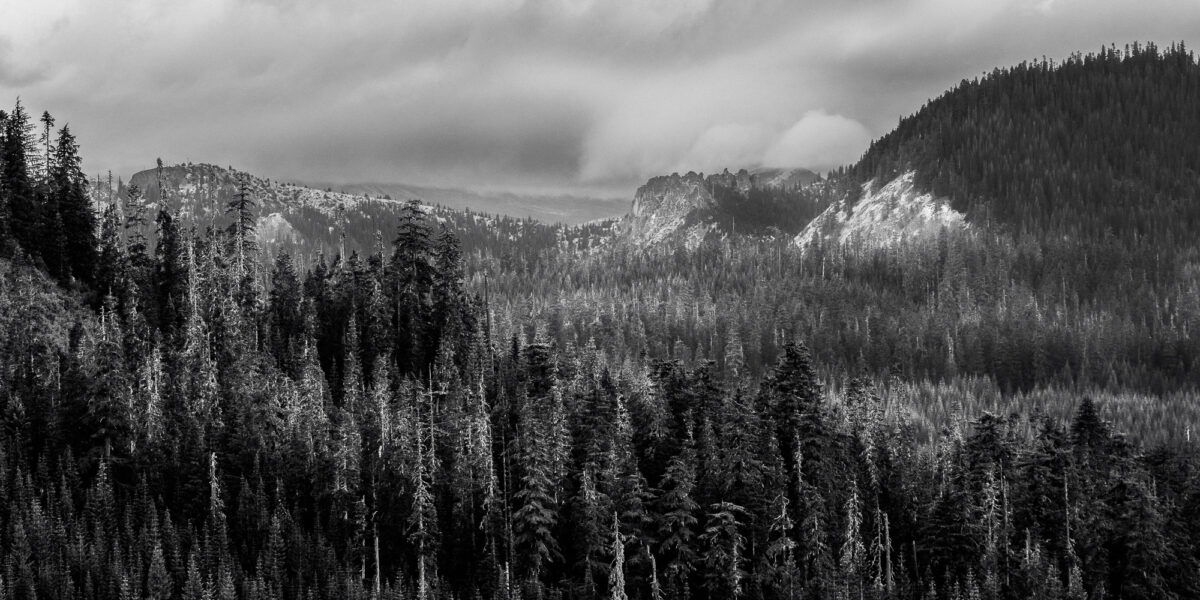
Continuing further up Ryan Lake Road, I found a great vantage point encompassing much of the Green River Valley, including Goat Mountain.
Typically, I capture my photographs in a 4×5 aspect ratio. However, some compositions call for a panoramic approach. This scene needed to be shot wide to fully capture the expansive view.
When I want to include multiple subjects on the same plane but spaced apart in the frame, I’ll often shoot a panorama in a 2:1 aspect ratio. In some locations, I’ll even go as wide as 3:1 to convey the vastness of the area without including unnecessary elements.
View the behind the scenes video of this location HERE.
Meta Lake
After photographing the scenic Green River Valley, I drove over Norway Pass, where I found a vantage point overlooking Meta Lake.
Meta Lake was situated within the blast zone during Mount St. Helens’s eruption in 1980. Remarkably, small flora and fauna protected by the terrain and buried under 8 feet of snow survived the initial blast.
Over the past four decades since that fateful event, the forest around Meta Lake has steadily regenerated. A few silver snags that managed to withstand the initial onslaught of the eruption can still be seen standing.
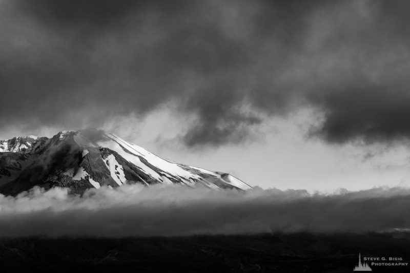
Mt. St. Helens
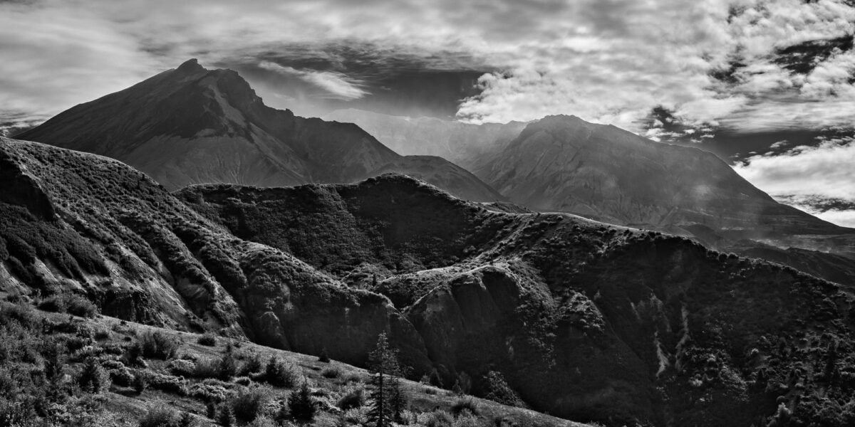
After leaving Meta Lake, Ryan Lake Road connects with Forest Road 99, which leads to the Windy Ridge Interpretive Site on the flanks of Mount St. Helens at an elevation of around 4,000 feet.
Like Ryan Lake Road, Forest Road 99 has sections of gravel and some severe dips where the pavement has sunken over time.
On this particular trip, I decided to skip the various interpretive sites and scenic viewpoints along the route. Instead, I drove straight to the end of the road to take in the iconic sight of Mount St. Helens.
After experiencing the familiar yet always awe-inspiring view of the mountain, something I’ve enjoyed on multiple visits over the years, I looked to capture a composition slightly different from my previous photos.
Once again, I opted for a panoramic shot of Mount St. Helens. I wanted to include the ridges in the foreground this time rather than just focusing on the mountain. The contrast of the light helped to bring out the intricate textures and features of the terrain. Beyond that, the towering form of the mountain loomed in the distance, with views into the crater softened by the atmospheric conditions.
Spirit Lake
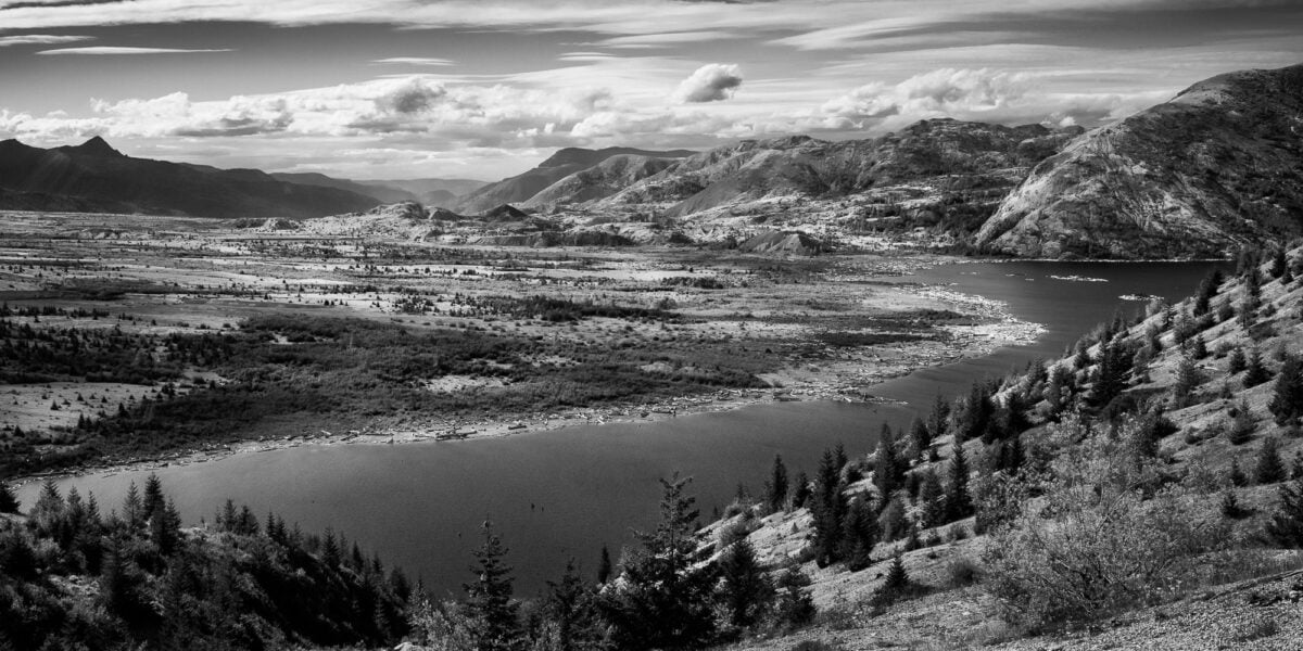
After capturing my photograph of Mount St. Helens, I only had to take a few steps to reach the viewpoint overlooking Spirit Lake. Before the 1980 eruption, Spirit Lake was a pristine, forested lake that offered stunning views of the cone-shaped Mount St. Helens.
In this panoramic photograph, I aimed to showcase a section of Spirit Lake and the pumice plains, where a massive lahar of mud and melted snow surged down the valley following the initial high-heat blast of the eruption. One can still see the remnants of trees taken out during that fateful event, their trunks lining the banks and floating on the lake’s surface.
Smith Creek Valley
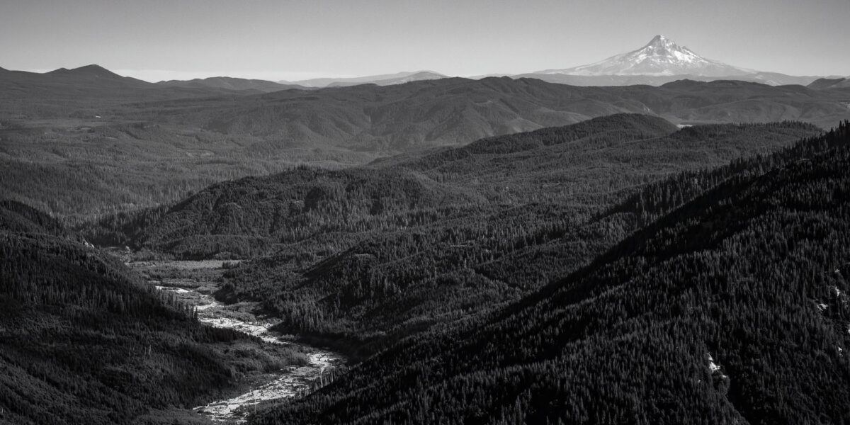
With the sun starting to dip lower in the sky, I decided to explore one more area before calling it a day. As I made my way to my next destination, I couldn’t help but stop for a photo when I caught sight of this stunning view of Oregon’s Mount Hood overlooking the Smith Creek Valley.
Once again, I opted for a panoramic aspect ratio to fully capture the story of this landscape. Here, multiple focal points – the winding river and the iconic mountain tie the entire scene together. Since the sky was clear and cloudless, I included just enough overhead space to frame Mount Hood without any distractions. The bright, contrasting bed of Smith Creek and the tonal differences between the ridges create a lovely leading line that draws the eye from the corner of the frame to the distant mountain peak.
Elk Pass
With daylight fading, I decided to limit my additional stops along Forest Road 99 on my way back to Forest Road 25. My goal was to explore the area near Elk Pass.
Heading south on Forest Road 25, I turned onto Forest Road 2551, which I’ve also discovered is known as the Snyder Pasture Road when using digital mapping.
Forest Road 2551 holds deep personal meaning for me. In his later years, my dad would often camp in this area. He loved this part of the Gifford Pinchot so much that he requested his ashes be spread here. Though I can’t confirm or deny whether that request was ever fulfilled, the road and surrounding landscape remain special to me.
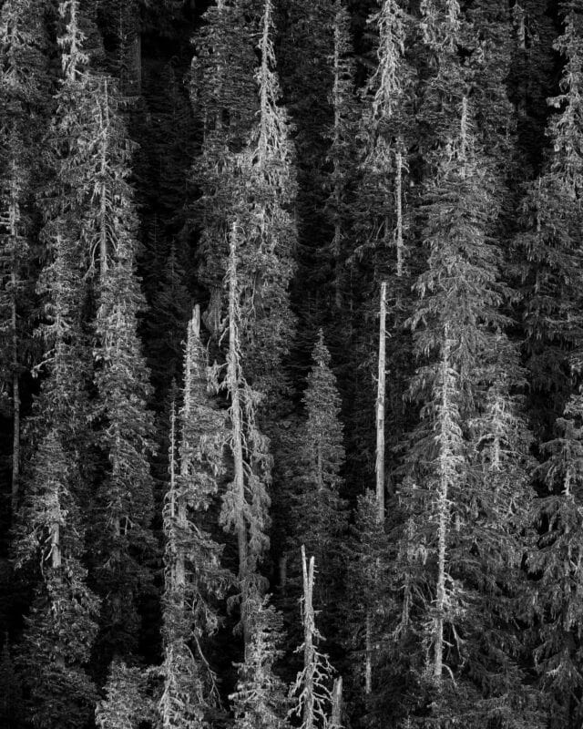
It’s been a while since I’ve been in this area, so I set off down the familiar road with the limited daylight remaining. A composition that immediately caught my eye was the forest scene across the valley where Elk Creek flows. I’m always drawn to locations where you can look across a canyon or valley onto a hillside blanketed in old-growth trees.
The Moon
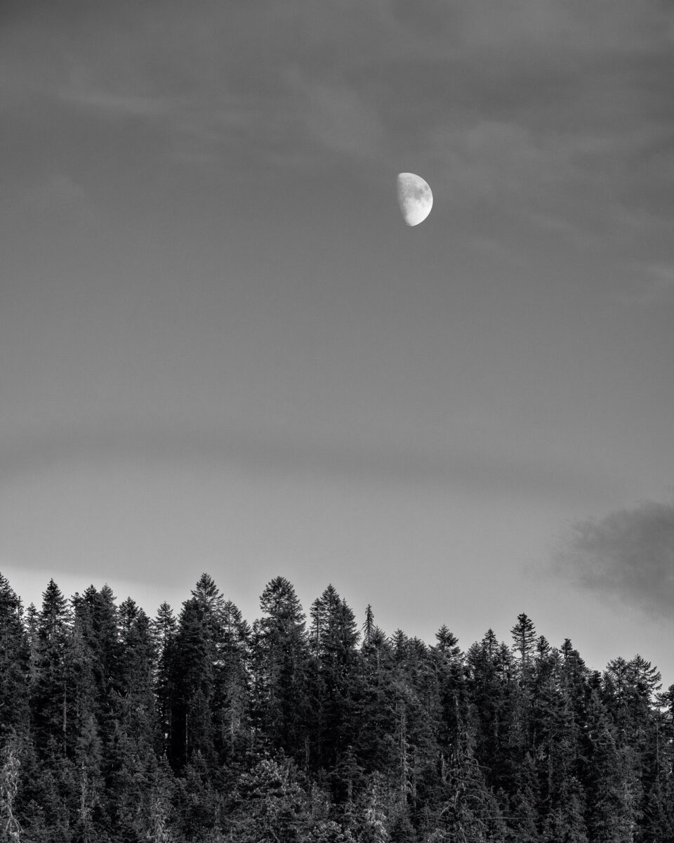
Further along the road, I saw the moon rising over an unnamed forested ridge just as the golden hour was beginning. Fortunately, the sky remained clear, allowing me to capture the details of the waxing moon.
I continued driving until I reached the end of the road. There were undoubtedly other areas I could have explored, but with daylight fading fast, it was time to start heading back. Another visit would be needed to fully experience all this region has to offer – perhaps next time, I’ll plan to camp overnight and extend my time here.
Elk Creek Valley
As darkness began to settle in earlier than usual due to the cloudy conditions in the mountains, I came across this striking view of the Elk Creek drainage on my way out. To capture the sheer scale and vastness of the scene, I knew another panoramic image would be the best way to tell the story.
When I made it back to Forest Road 25, it was pretty dark. I would have loved to spend the night camping in the area, but with my work schedule the following day, that wasn’t an option.
The Gifford Pinchot National Forest remains a perennial favorite of mine. There are still so many remote and wild areas to discover, and its relative distance from the major population centers of Seattle and Portland helps deter heavy visitation. I can spend weeks exploring and never run out of new sights.
As the sun set and I began my drive home, I eagerly anticipated my next opportunity to return to this special corner of Washington State. The Gifford Pinchot’s rugged beauty, abundant wildlife, and the personal connections I have to this land continue to draw me back time and time again. It’s a place that fills me with a deep sense of wonder and appreciation for the natural world.